Seiad Valley

20110810-091141.jpg

20110810-091325.jpg

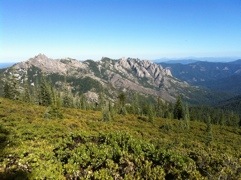
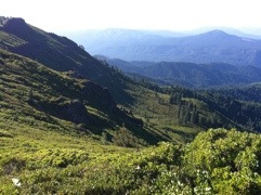
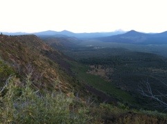
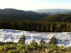
The highlight of a long climb out of Seiad Valley this morning was a striped skunk which ran across the trail right in front of Honeybuzz and me, leaving just a faint musky scent as it passed. Otherwise I was glad to reach the top of the hill, with distant Siskiyou peaks across the Oregon border to the north, and spent the rest of the day ridgewalking.

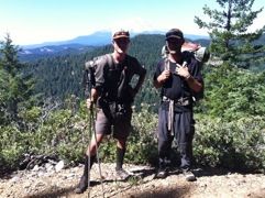
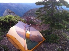
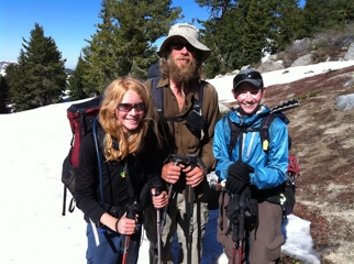
Well, except a two-hour break for lunch when my mom met us at a road crossing, and another two-hour break to chat with a southbound hiker named Brian (or, as he calls himself now, Overload) who I last saw in the desert more than a thousand miles ago; so, despite camping after dark, we only gained 21.7 miles today. Hoping for a longer effort tomorrow.

Down, Down, Down

20110809-064419.jpg

From my wilderness camp near Marble Mountain, I cruised 26.6 miles to Seiad Valley this morning, arriving there at 3:30 p.m. The last 20 miles were literally all downhill, dropping a quad-quivering 6,500 feet from snowdrifts on bare mountain slopes to 95-degree heat on the valley floor; it was the biggest single elevation change I’ve yet encountered on the trail. Looks like I’ll pay for it in the morning with a 5,000-foot climb over the next ten miles, but that’s for tomorrow…

My mom met me after her own adventure with a flat tire and front brake replacement (1,600 bucks’ worth), and we’re staying in a nice cabin tonight; I just polished off two pints of Ben and Jerry’s ice cream before dinner. This will be the last civilization I see before hitting Ashland, across the Oregon border; just 1,000 miles left before Canada – really flyin’ now!

The Goat People

20110808-051902.jpg

I hiked 28.9 miles through the Marble Mountain Wilderness today, crossing endless, long, high ridgelines covered in wildflowers and lots of bear poop.

Perhaps the weirdest moment of the day was when a loose flock of people and animals materialized from the woods onto the trail right in front of me, coalescing into two men, a woman, two tiny children, two dogs, and 14 goats. They were all covered head to toe in dirt, wearing rags, and obviously hadn’t seen civilization in quite a while. One of the guys explained that they were spending the summer in the forest, gathering wild food where possible, and drinking a lot of goat milk; he carried a rifle, mostly to protect the goats since a mountain lion got one of them last year; and was eager to ask today’s date. Interesting folks.

Bear

20110806-071506.jpg

This morning I awoke to the unexpected sound of a Spotted Owl calling outside my tent, but even bigger wildlife was afoot today. About midmorning I spooked a black bear off the trail, not too far in front of me, and had a nice look at its furry backside as the beast ambled away downslope. The encounter was most notable because it took 1,591 miles of hiking before my first bear sighting on this trip; somehow I made it all the way through the Sierra without spotting much more than an occasional dry track. Anyway, I finally saw one!

I walked 20.1 miles in just under six and a half hours today, crossing the Russian Wilderness en route to a lazy afternoon at an air-conditioned motel room in Etna, and a burger and shake for dinner. Looking forward to hitting Oregon in four days.

Mountain Quail

20110806-041444.jpg

20110806-041507.jpg

I’ve seen hundreds of Mountain Quail on this hike so far (more than the rest of my life combined!), but never imagined I’d catch one. Honeybuzz practically stepped on the bird huddled in the trail this morning, clearly sick or injured, and I grabbed it to admire the beautiful plumage up close for a minute. There was nothing further we could do, so, hoping for the best, I left it in a bush and we continued on our way.

Thunder clouds appeared in the Trinity Alps Wilderness this afternoon and we had a brief rain shower – the first precipitation I have had on this entire trip! Not even enough to get the ground soaked, but the air is heavy and sticky as I drift off to sleep after a 28-mile day.

More Characters

20110806-041335.jpg

I caught up today to a couple more PCTers I hadn’t yet met: Sniper, probably the northernmost solo female, who was laid off from two different jobs in just a few months so decided to go hiking this summer, and who now carries several bleached vertebrae and a giant pirate flag dangling from her pack; and Slapshot, who had just returned to the trail after a mystery fever landed him in the emergency room on an IV for the last three days (he seems all right now, though the doctors never figured out the cause).

Honeybuzz and I logged 27 relaxed miles between eight a.m. and eight p.m. – an exceptionally smooth day of walking since my mom intercepted us at a road crossing around lunchtime with all sorts of goodies (Honeybuzz drank seven cans of soda, for starters), and since the trail was well-graded, flat, and scenic, in contrast to yesterday’s big climb. Definitely one of the most pleasant days I’ve had on this trip so far.

An 850-Mile Shave

20110804-085302.jpg

20110804-085330.jpg

20110804-085352.jpg

One of the perks of having my mom visit this week is that she brought my razor, so, for the first time in more than a month (and 850 miles), I had a shave this morning. What a difference! I also weighed myself and discovered that I’ve lost six pounds since the beginning of this hike; not bad, since a guy just ahead of me has already lost 65, and most PCT hikers are down at least ten pounds by now.

Honeybuzz and I hiked 25 miles westward, with a stiff 4,600-foot climb past Castle Crags State Park, after crossing Interstate 5 this morning near Dunsmuir. A freeway sign there said 75 miles to Ashland, kind of depressing since it’s still 240 miles away by trail. This path is certainly circuitous.

1,500

20110802-090245.jpg

20110802-090322.jpg

I hit the 1,500-mile mark about 5:00 this afternoon, near the end of a 27-mile day. Woo-hoo! Only 200 more miles to the Oregon border… should be there in eight days.

Lots of long forest traverses today. It was fun to meet Laura and her husband, section hikers heading south, who have been reading this blog – thanks guys (and, yes, your feather was from a Red-tailed Hawk)! Even better, my mom drove down from Oregon and met Honeybuzz and me at the end of the day; we are staying in a motel in Dunsmuir tonight.

Westward

20110802-123933.jpg

Though I can practically see Oregon on the horizon, the PCT takes a long sweep west in this section, and even heads south for a little while, so I’m resigned to several days without any northward progress. Honeybuzz and I hiked about 26 miles today to set ourselves up to reach Interstate 5 at Castella tomorrow.

I ran across my fifth rattlesnake of the trip – and my first since leaving the southern California desert – coiled and rattling in a rock pile alongside the trail this afternoon; kind of weird to find one in an oak forest. We met a german guy named Buttercup yesterday, wearing an obvious Reese’s Peanut Butter Cup T-shirt, who claimed to have flicked a rattler into a creek with his trekking pole to get it away from his tent the night before; another hiker named Doc, who is camped with us tonight in his backpacking hammock, said he also encountered a rattler this week, so they’re definitely around. Bears are supposedly here, too, but I still ain’t seen nary a one on this trip…

Walking In The Woods

20110802-124111.jpg

After crossing the Lake Britton Dam, it was nice to ascend slightly into mid-elevation forest today where the trail traversed shady groves of firs and pines along endless ridges. Honeybuzz and I hiked steadily all day and camped next to a creek after 29.1 miles.

In an open area near some cliffs this afternoon, I looked up in time to watch three Peregrine Falcons swooping and diving right over my head, probably a local pair chasing off an intruding young bird. It was a nice distraction; the trail was pretty monotonous today, although I did catch up to five PCTers I hadn’t met before (Red Blaze, Half Fast, Wetsmoke, Wiz, and Buttercup).

As far as I can tell, there are about 30 hikers ahead of me now, out of 400 who set off this year from Mexico intending to walk to Canada (many of whom have since quit, skipped, or flipped). Almost everyone started two and a half weeks before me (I know of only one person who started later), so I’ve now passed the majority of the northbound herd. If I stick to schedule, I should hit Oregon about August 10th.

Burney Falls

20110730-091721.jpg

20110730-091739.jpg

20110730-091756.jpg

Definitely the hottest day I have had so far. I’m currently lying inside my tent stripped to my skivvies with the sleeping bag thrown to one side, and, even after dark, I’m still sweating.

Honeybuzz and I hiked 27 miles through the heat today, beginning up on the Hat Creek Rim and finishing just past Burney Falls State Park, where I picked up a resupply package and snacked on two hot dogs, an ice cream taco, and a quart of milk. Lots of rough lava rocks really beat up our feet this afternoon – hoping for softer, more pine-needly tread tomorrow.

The Hat Creek Rim

20110729-103611.jpg

Honeybuzz and I rolled out of Old Station late this morning, having walked into the deli one minute after opening and immediately ordered two large pizzas for breakfast. Thus fortified, we hit the famous Hat Creek Rim.

The Rim spans the longest waterless stretch on the whole PCT – about 30 miles – and much of it is shadeless, exposed, and covered with lava rock, reminiscent of some of the desert sections farther south. This afternoon reached about ninety degrees, and I was glad for my reflective umbrella. I carried five liters of water (ten pounds) and Honeybuzz carried six, but we needn’t have worried; after hiking 20 dry miles, we hit a well-stocked water cache at Road 22 (otherwise called Cache-22) with 25-30 gallons of bottled water and several lawn chairs among some juniper trees. Since it was past nine p.m. we threw down camp right there, ready for another dusty and hot day tomorrow.

Lassen

20110729-030004.jpg

I thought I might hit lingering snowpack in Lassen National Park, but it turns out that the PCT takes a wide swath around Mount Lassen through low, flat, dry forest, and I needn’t have worried. In fact, today might have been the warmest day yet, with my thermometer registering ninety degrees through most of the afternoon. Instead of snow, I’m now dealing with hot, waterless, and dusty conditions, and associated chafed feet.

After a luxurious breakfast at Drakesbad, I hiked with Honeybuzz, Turbo, and Furious for 24 miles to the small town of Old Station, where I need to pick up a resupply package when the post office opens tomorrow morning. Then it’s on to the infamous Hat Creek Rim – should be interesting, as I’ve heard much about it from other hikers…

Drakesbad

20110729-025905.jpg

20110729-025922.jpg

Forgive me if I talk too much about food, but it’s been on my mind a lot! I never can seem to eat enough on the trail, so today’s dinner was something special.

After an easy, 22-mile day I arrived at Drakesbad Guest Ranch – a hot springs and resort within Lassen National Park – just 15 minutes before dinnertime. The resort takes extremely good care of hikers: we’re offered free showers, free laundry, free access to the hot springs, free camping, and a 50% discount on all meals. I barely had time to set down my pack before they fired up an enormous barbecue and buffet line.

Within minutes I packed in a large steak, a double cheeseburger, a bratwurst hot dog, salad, two slices of watermelon, an ear of corn, three scoops of coleslaw, four slices of cheese, three white chocolate chip cookies, a brownie, and a Dr. Pepper, while other guests watched in appreciation. A quick dip in the hot spring pool helped digest, and I’m ready for breakfast in the morning…

Halfway There!

20110726-084918.jpg

At six p.m. Honeybuzz and I reached a small concrete post at a random spot in the forest. On the south side, it said: “Mexico: 1,325 Miles.” On the north side, it said: “Canada: 1,325 Miles.” Nice!

For the first time, I’m sleeping closer to the end than the beginning of this trail. Otherwise, the day wasn’t particularly noteworthy, although I did add Pileated Woodpecker to my trip list (I also notched a Pine Grosbeak and Black-backed Woodpecker this week); I hiked 27.4 miles today, mostly along forested ridges, grateful for some easy trail.

Belden

20110725-084922.jpg

After sleeping in a real bed last night (!), I headed to breakfast at a tiny restaurant around the corner in Belden. A peanut butter milkshake took priority, followed by scrambled eggs, French toast, sausage, and, finally, a blackberry milkshake.

When the post office opened, Honeybuzz and I hiked over there to shuffle some packages. I had three boxes waiting and mailed off my ice axe, traction spikes, rain pants, long underwear, and some extra food, which lightened my pack considerably. It’s summer, and the high Sierras are over: no more long days of slogging through snow!

By the time we hit the trail it was early afternoon, and we had a continuous, 14-mile climb from 2,400 feet (the lowest I’ve been in more than a thousand miles), where it was nearly 90 degrees, to over 7,000 feet, where we scrambled through snowdrifts before setting camp on a high ridge. Should hit Lassen soon.

Angel To Angel

20110725-073659.jpg

The morning began nicely with scrambled eggs, pancakes, sausage, and fresh fruit courtesy of the trail angels near Bucks Lake. Honeybuzz and I eased off to a late start when his pack’s shoulder strap snapped on the way out the door and had to be sewn, staplegunned, and duct taped together, so we didn’t hit the trail until nearly 11 a.m. No big deal, except 27.5 miles remained to Belden, where another trail angel might pick us up. Could we make it in time?

Of course. We practically ran across the entire Bucks Lake Wilderness and arrived in Belden, a tiny town known for regular three-day raves and biker gatherings, in time for burgers at the local restaurant with two other hikers, Turbo and Furious. The waiter brought four separate pitchers of water without prompting, a nice touch. Then we called the local trail angel and he happily picked the four of us up, dropping us at a cabin with beds, showers, kitchen, the works. Two angels in two days! This trail is too easy…

Mountain Lion!

20110724-052628.jpg

Honeybuzz and I hiked 30.3 miles today, my longest yet, with a leisurely seven a.m. start and a two-hour lunch break at the Feather River.

Near the end of a 4,000-foot descent to the river, Honeybuzz was about 100 feet ahead of me when he spooked a Mountain Lion off the trail. I heard a faint rustling in the leaf litter and looked up just in time to catch the big cat sprinting away downslope at full speed through the oak trees, gone in a second; Honeybuzz also heard it but unfortunately didn’t see anything. Last week I followed cougar tracks for about a mile along a snowy section of trail, on top of the prints of hikers just a couple hours ahead of me (and heading the same direction…) but to actually see a Mountain Lion, however briefly, was unexpected and awesome! We also found a Rubber Boa on the trail this morning, my second in three days, and I was pleased to stumble into a colorful King Snake today – a good day for wildlife.

At about eight p.m. we had just hit 30 miles after climbing 3,000 feet up from the river and were searching for a flat spot to camp when the trail suddenly bisected a remote gravel road. As I stepped out to cross it in the dusk, an SUV came flying around the corner, headlights flashing – it was Honeybuzz’s dad, who had teamed up with a local trail angel named Nancy while visiting. Somehow, incredibly, they drove up to leave a note at that intersection at the exact moment we hit it; ten seconds either way and we’d have missed each other. Within 30 minutes I was being fed a burger and barbecued ribs. And, instead of my tent, I’m sleeping on the back deck of a beautiful two-story cabin in the woods tonight, showered, with breakfast promised in the morning. Who knew?

Ridgewalking

20110724-052543.jpg

I spent the day walking with Honeybuzz and we made good progress despite about ten miles of snow. My GPS once again proved extremely useful, and I fell five times on slippery traverses this morning, sliding into tree wells on three occasions. Otherwise, the trail generally followed long, dry, forested, gently undulating ridge tops, with occasional views of distant peaks, and, by the end of the day, we’d hiked 27.2 miles.

To reach Canada by September 15th, my original goal, I’d now have to average 25.8 miles per day, with no days off, for the rest of the summer. It’s possible, but we’ll just see how things go; I’d still be happy finishing before October 1st, after which northern Washington starts getting winter snowstorms. Anyway, that’s still 1,400 miles away…

Strawberries On A Mountain

20110724-052439.jpg

For the first time in almost four weeks I dropped below 6,000 feet, hiked on clear trail all day, and even broke a sweat because it was summery and warm outside. No snow at all! Kind of ironic, then, that today’s top headline in the Reno newspaper was “Snow Bogs Down Hikers.” I put in about 17 miles, not including a several-hour detour into Sierra City to resupply, shower, and drink a couple of large milkshakes (one chocolate, one banana).

For this section I’m trying something new and delicious. I stuffed an entire gallon-sized ziplock full of fresh produce bought at the general store in Sierra City – strawberries, blueberries, bananas, green peppers, and mushrooms – and tucked it carefully to avoid smashing in my pack. Never mind that it weighs a couple extra pounds, or that the peppers turned out to be spicy jalapeños; fresh fruit in the wilderness is almost too wonderful to be believed, and I just ate an awesome dinner at camp high on an exposed ridgetop, watching the panoramic sunset. Life is good.

Ups And Downs

20110721-040010.jpg

I woke up late this morning feeling depressed, exhausted, with a headache, and dreading the next section of snow-covered trail. Things could only get better from there, and they eventually did – after I’d slogged through 15 miles of snowpack, wandering alone in a confusing forest for most of the day with just my iPhone’s GPS for guidance, I suddenly hit unbelievably easy, clear trail in midafternoon and my morale soared into the evening.

The mental roller coaster on this trip has been pretty interesting. I feel the ups and downs more intensely when hiking alone, especially the gnarly stuff, but I’ve found that things change quickly out here; each day is very much its own adventure, and tomorrow will probably be completely different than today. That’s one of the best things about the trail: you’re never quite sure what to expect from it. Anyway, it was nice to catch up at the end of the day to Annie, Honeybuzz, and three hikers I hadn’t met before – Meow Meow, Liz, and Funyun – so I have company in camp after putting in a solid 25.1 miles.

Two Months

20110719-104622.jpg

20110719-104639.jpg

Today marks exactly two months on the trail, during which I’ve walked every day except for one day off. Though I haven’t quite hit the halfway point yet, I’m hoping to be finished in another two months with bigger mileage ahead.

This morning I walked with Balls and Sunshine for a while before we met Wired in the Granite Chief Wilderness, looking a bit stressed since her GPS had run out of batteries. The four of us continued on to Donner Pass (like, the actual area where the Donner Party ate each other), then I headed north alone while the rest hitchhiked in to Truckee. Lots of heavy, frustrating snowpack today, but I still managed to squeeze in 27 miles with a few stretches of dry trail to give me hope. Onward!

Miles With Sunshine

20110718-101410.jpg

20110718-101432.jpg

Despite several hours in snow, I hiked 29.1 miles today – my longest day of the trip so far. I spent 14 hours on the trail, from 6:30 to 8:30, without many breaks.

About midafternoon I caught up to Sunshine and Balls, a cheerful 11-year-old girl hiking the whole PCT with her dad this summer. They’re an entertaining couple, serious hikers, and I was happy to get the chance to walk with them after hearing of them over the past few weeks from other hikers. We are camped tonight on top of a knife ridge overlooking Lake Tahoe, sheltering behind an isolated tree in a brisk wind, happy to have put in a solid effort today.

Echo Lake

20110718-073605.jpg

This morning kicked off with five miles of heavy, continuous snowpack inside dense forest – ugh. But then Honeybuzz, Annie and I dropped down to cross busy Highway 50, twelve miles west of South Lake Tahoe (where, apparently, a celebrity golf tournament this weekend is featuring Michael Jordon among others), and walked into the Echo Lake Resort.

Echo Lake marks the end of the high Sierras, though you wouldn’t know it from all the snow everywhere this year. Still, I’m beginning to hit long stretches of dry trail, and it can’t come soon enough; if I want to make it to Canada in September, 15-mile days just won’t cut it anymore. Today I pushed 21 miles despite a four-hour break at the Echo Lake store to resupply and drink milkshakes – and I’m camped tonight well inside the Desolation Wilderness, with snow drifts and pine trees as my closest company.

Carson Pass

20110717-090129.jpg

20110717-090147.jpg

Today was a breakthrough day: the trail was relatively clear of snow, and, though we got lost a few times, Honeybuzz, Annie and I were able to maintain a good pace and hiked 26 miles – my biggest day since hitting the Sierras.

We crossed Highway 88 at Carson Pass and talked for a while there with a ranger named Tom. He surveyed us on whether we packed out our used toilet paper or buried it (split responses), gave a conditions report, and then mentioned that a motorcyclist had missed a curve at the pass and died about an hour earlier, 100 yards from where we were standing. As it turned out, we had to walk past the fatal spot to rejoin the PCT, and, while we quietly passed a few feet away on the shoulder of the highway, several sherriffs were loading the bagged body into an unmarked van. It was an intense and sad moment, backed by Tom’s earlier advice: “Remember to smell the flowers and listen to the birds out there. Appreciate it while you can.”