Ebbetts Pass Magic

20110716-073417.jpg

20110716-073435.jpg

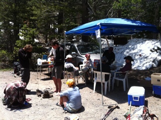
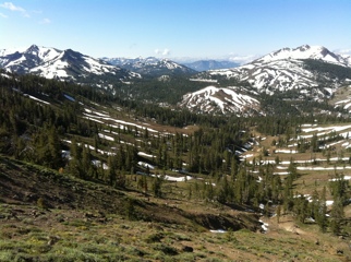
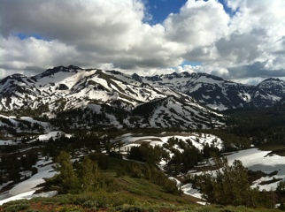
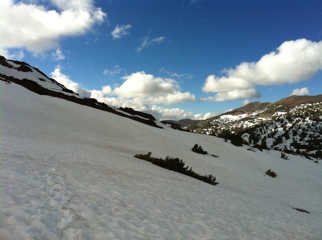
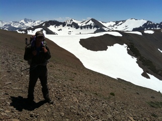
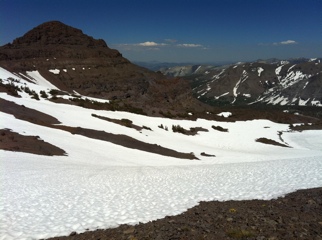
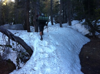
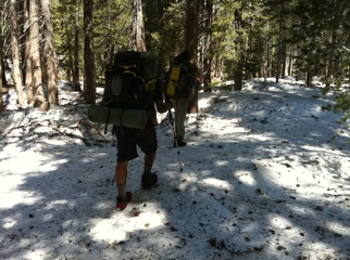
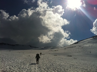
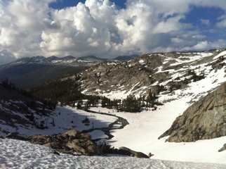
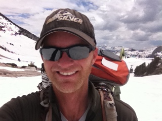
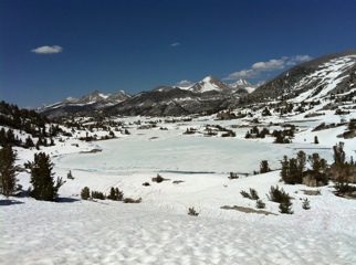
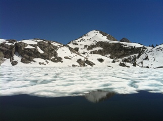
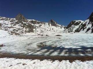
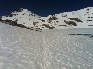
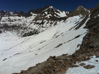
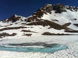
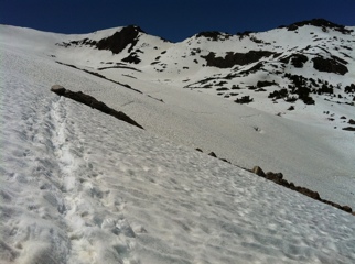
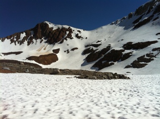
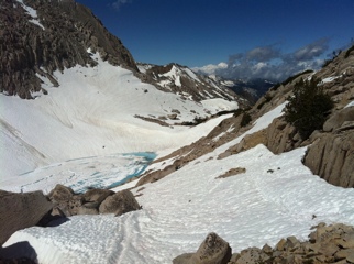
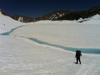
After nine miles of wandering through snow-covered forest this morning, and getting lost a few times, I hit Ebbetts Pass at Highway 4 before noon. Expecting a bare and remote mountain road crossing, I was surprised to find a blue canopy there: trail magic!

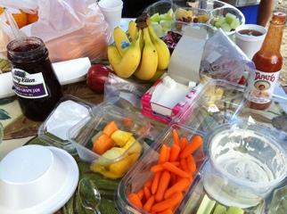
A friendly guy named Doug had just set up an incredible pit stop for PCT hikers and planned to keep it going for three days. He laid us out a feast: cooked eggs, toast, Captain Crunch with whole milk by the gallon, apple juice, homemade brownies, hot chili, coffee, hot chocolate, bananas, strawberries, oranges, a fruit and veggie tray, Coke… I stayed and ate for four straight hours with 15 other hikers while Doug catered to every need. He’d even set up a pharmacy box with all kinds of medications, plus a box full of extra equipment from shoelaces to pocketknives, and charged people’s electronic devices on his car charger. Fully powered up, and morale totally restored after a tough couple of days, I eventually pushed another eight miles to camp with Honeybuzz and Annie. Thanks, Doug!

Snowy Forest

20110715-062518.jpg

This morning my thermometer read 29 degrees, and my shoes were frozen rock solid outside my tent. Isn’t this mid-July in California?

I spent the day hiking with several others, most of the time on snow, often off trail since we kept getting lost. Navigation in the forest with ten feet of snow on the ground is very difficult; a GPS helps dramatically (for instance, a guy we met today who didn’t have one had just spent three hours wandering in random circles) but when the trail is totally obscured you’re bound to bushwhack a lot no matter what, and progress this afternoon was gauged in long traverses and some entertaining boot-skiing straight down a set of buried switchbacks, totaling 16 miles. Clouds are rolling in and it’s still cold – hope the weather holds off.

North From Sonora Pass

20110715-062342.jpg

20110715-062403.jpg

It was hard to escape Bridgeport this morning. After mailing my bear canister home at the post office, buying a few groceries, and eating a giant avocado burger for breakfast, it was time to hit the road. Five of us lined up at the edge of town to hitchhike back to the trail at Sonora Pass, and eventually got a ride with two funny ladies in a Suburban who insisted on taking us to a thrift shop in nearby Walker (where Boots purchased a much-needed set of pants, since his crotch has been ripped and he wears no underwear) and bought us Gatorade, before dropping us at the trailhead.

So, I didn’t get hiking until 4:15 pm, and put in a short six miles before camping with half a dozen other PCTers. This next section, 76 miles to Echo Lake (by South Lake Tahoe), should be easier than the last, but I’m still expecting about 60% of the trail to be covered in snow. Just gotta take it one day at a time…

One Thousand Miles!

20110712-100911.jpg

20110712-100930.jpg

At about eight this morning I hit the 1,000-mile mark, appropriately enough at a thigh-deep stream crossing. Only 1,650 to go until Canada!

Otherwise it was a solid day. I put in more than 20 miles to reach Sonora Pass and hitchhiked with some other PCTers to a town called Bridgeport, where I’m sleeping tonight in a bed for the first time in weeks. Even the hiking today was easier and more scenic than in recent days, concluding with an eight-mile stretch above 10,000 feet along a high ridge. Looking forward to hitting the trail again tomorrow with fresh legs.

Endless Snow

20110712-071352.jpg

20110712-071415.jpg

This morning the water had dropped significantly and we were able to cross the river in Stubblefield Canyon before the sun hit, though it was waist-deep, fast, a little scary, and ice cold. Thus began today’s slogfest.

The farther north I go, the more snow I encounter, and the more demoralizing it gets. Today we were only able to make 14 miles in 11 hours of intense hiking, mostly navigating by GPS through a forest full of 10-foot-high snowdrifts piled like slippery vertical sand dunes. Climbing up and down the drifts is utterly exhausting, even in level terrain; when the route leads straight up a steep ridge, it’s almost suicidal.

So, forget the trail: this is a montane expedition interspersed with a few miles of scattered hiking. Looking at it that way, it’s quite an adventure. Still, I’m looking forward to the day when I can just walk on a regular trail all day; that might be a while, though…

Slogging North

20110712-071217.jpg

20110712-071243.jpg

These mountains are wearing me like ice on granite. Another absolutely brutal day today had me feeling a bit less invincible than usual by dinnertime.

Quake, Unload, Honeybuzz and I lost the trail directly out of camp under five feet of continuous snow and spent a frustrating hour downclimbing a series of steep cliffs and waterfalls to reach a canyon bottom, where two thigh-deep creek fords awaited. Then we climbed a pass, where the trail disappeared again under snow, and then again we dropped straight down into a steep-sided gorge. Traversing down upper Kerrick Canyon, it took an hour to inch just half a mile across incredibly steep, icy snow slopes which ran straight into a raging river below.

By the time we found exposed trail it was climbing a steep ridge, and the descent down the back side was so rough I ripped a 2-inch hole in the mesh of my shoe. At that point we hit Stubblefield Canyon to discover a river eight feet deep and running fast blocking the trail. Ain’t gonna get across that today, so we camped after a tough 14 miles, hoping the water drops by morning.

Day 52: Yosemite Backcountry

20110712-071113.jpg

It took 12 hours to cover 20 very strenuous miles today, pushing hard all day without many breaks. I hiked with Honeybuzz, Quake, and Unload as we bullied our way through miles of continuous snow (often bushwhacking and navigating by GPS when we lost the trail), clouds of mosquitoes, 3,500 feet of elevation gain, and several thigh-deep stream crossings.

I have a heavy pack on this stretch (35-40 lbs) but am happy to be carrying enough food. Last week I rationed hard during the most intense section of high passes before resupplying at Vermilion Valley, and lost enough weight to contemplate weaving a belt out of dental floss. (I haven’t stepped on a scale since beginning this adventure). So I’m on a mission now to eat 5,000-6,000 calories a day to keep from shriveling up out here; can’t afford to get any skinnier.

Yosemite

20110712-070959.jpg

20110712-071022.jpg

In a stroke of magnificent timing I arrived at the Tuolumne Meadows store and post office about one hour before it opened for the season this morning. Soon I was eating bananas and ice cream with about ten other hikers out front, celebrating our arrival at Yosemite, and, by the time I’d fetched three resupply packages, mailed one out (their first outgoing parcel of 2011), and munched many rounds of junk food, six hours had passed.

I finally burped and farted my way out of there, swaying under a heavy load with a week before my next stop, blissfully happy. After an easy 15-mile day, I’m now camped by the Tuolumne River with a bunch of other hikers, six million mosquitoes, and – according to the rangers – a problematic mama bear, so it’s bound to be an interesting night.

Donohue Pass

20110712-070828.jpg

20110712-070843.jpg

I drifted into another group of hikers and walked with four young guys over Donohue Pass (11,000 feet) today. It was a very tiring 20 miles, more than half on snow, with 3,500 feet of elevation gain, constantly watching thunderstorms roll past in adjacent valleys, but quite satisfying even though we didn’t reach the summit until past 5 pm. And I’m in good position now to hit Tuolumne Meadows, a major landmark, tomorrow morning.

I continue to be amazed at the sheer amount of water everywhere as the snow melts. Around midday we negotiated a set of three creek crossings which, in a typical year, might barely get your feet wet. For the deepest one all five of us linked up, hanging on to each other to ford the waist-deep river, and Honeybuzz, who took the upstream position deflecting the brunt of the current, admitted he probably couldn’t have stood up alone; it was too strong. Wet feet all day isn’t so bad, but I do grimace when putting on soaking, cold shoes each morning…

Reds Meadow

20110706-091140.jpg

I took the wrong trail out of camp this morning and ended up a mile and a half down a steep set of switchbacks before I realized they were leading the wrong direction, thus wasting an hour. Oops.

Much of the rest of the day was spent playing a tiring game of hide and seek with the trail in dense forest with five- to ten-foot snowdrifts stacked like frozen sand dunes everywhere. For one two-mile stretch I bushwhacked straight through the woods, crawling over blowdowns, slipping and sliding on waves of compacted snow, glad for the excellent GPS in my iPhone. But I reached Reds Meadow (near the Mammoth Mountain ski area) in early afternoon and celebrated a rest stop with a couple of ice cream bars, while watching a distant thunderstorm, before moving on to a 17-mile day. Hoping to reach Yosemite day after tomorrow.

Silver Pass

20110706-124415.jpg

20110706-124435.jpg

A late start since I had to wait for the morning ferry out of VVR, but I returned to the trail by 10 am with a new crew of hikers, and spent the rest of the day walking with Crasher, Flash, and Noodles Romanov. We climbed 3,000 feet to Silver Pass, which was snow-covered but not particularly noteworthy, then worked slowly north, putting in a solid 16 miles by dinnertime.

I met an interesting fellow named Caveman this afternoon, bearing a striking resemblance to that Geico guy. He had no maps for this section and had just completed a massively frustrating ten-mile circle after getting lost in the snow. While looking over our maps, he told us a bit about his aspirations to become a professional cage fighter, then apparently decided to try to night hike the remaining 15 miles to Mammoth when his friend Eight Mile arrived. Good luck, guys… I’m going to sleep ;)

Vermilion Valley Resort

20110704-074638.jpg

After 13 days of the most intense hiking I have ever done, 175 miles through the toughest terrain on the PCT (with a side trip to climb Mt Whitney), I made it to Vermilion Valley this morning in time to catch the ferry across Lake Edison, and spent the rest of the day gorging on pancakes and burritos. Civilization!

Going almost two weeks without resupplying through the high Sierras, especially this year, was crazy, but I’m so glad I did it. Lots of hikers are skipping this section or trying to “flip” to another piece of trail after getting psyched out on hype, scared of all the snow, but they’re missing out; the Sierras are really incredible, probably the most rewarding part of this whole experience. Why hike the trail if you’re gonna skip its crux?

For me, the mountains ain’t over; I keep hearing about lots more snow and high rivers in Yosemite, a few days north. Apologies for the delayed entries this week – I haven’t had cell service in eight days, but will continue to post whenever possible. Happy Fourth of July!

Selden Pass

20110704-065244.jpg

20110704-065303.jpg

The biggest excitement today was not Selden Pass (which required the usual 3,000 foot climb, awesome vistas, and a few miles of continuous snow; nothing new) but a series of creek crossings in late afternoon, after dropping back below 10,000 feet, near the end of a 20-mile day.

Bear Creek was the worst. I was hiking with Skipper and Dane when we hit the creek about 6 pm, in full force, and we scouted for a crossing for about 40 minutes before committing. It was impressive: 40 feet wide, waist deep, and fast. We forded using a tandem method where everyone lines up side by side, faces across the river, and weaves their arms around each other’s backs to hang on to opposing shoulder straps. Actually, pretty safe. I’m just glad I wasn’t alone; I’ve walked in a group of three to twelve hikers through the Sierras so far, which makes all the obstacles easier to manage, and the scenery easier to appreciate!

Muir Pass

20110704-065132.jpg

20110704-065147.jpg

20110704-065205.jpg

The typical Sierra routine: I got up at 5:30, slogged up a 3,000 foot climb, lost the trail, and walked over rotten snow for 10 straight miles above treeline before dropping into another lush valley to camp by a river. It’s been pretty much the same every day this week, and today was no exception.

Muir Pass is more gradual than its neighbors, which means more time spent in snow on the approach and descent. But at least I wasn’t alone – there were 17 PCT hikers sitting on top when I arrived, some of them lounging inside a stone hut dedicated to John Muir. Perhaps the most exciting moment today was when one of them began an epileptic seizure at 12,000 feet, but fortunately it passed quickly.

In late afternoon I forded Evolution Creek, 40 feet wide and hipbone-deep but moving sluggishly in a meadow. Looks like I’ll reach my next resupply point, Vermilion Valley Resort, day after tomorrow. Can’t wait for a real meal and a shower – I haven’t changed my underwear in 13 days.

Mather Pass

20110704-065040.jpg

20110704-065056.jpg

Some say that Mather Pass is the most dangerous section of trail on the entire PCT; deep inside a remote part of Kings Canyon National Park, Mather links two Sierra peaks with a thin, cornice-topped knife ridge, more than 12,000 feet high, and extremely steep-sided.

It certainly depends on weather and snow conditions, but I didn’t see the big deal. The hardest part was the approach; it took five hours to fight six miles uphill through sun-cupped and slushy snowfields to the base of the pass. Sure, there was a steep traverse at the top, but kicked-in steps and a good hold on my ice axe made it quite safe.

I glissaded down the back side with Goodness, Zm, Skipper, and Dane, and, after a few more miles of snow travel, we dropped low enough to find exposed trail (!) at an endless series of switchbacks called the Golden Staircase (or, as one guidebook mistyped, the Golden Suitcase) which led into a remarkably lush, snow-free valley. On regular dirt tread for the first time in several days, we logged a gloriously fast ten miles in late afternoon and stopped to camp at 9:00 pm after a very long 21-mile day, ready to hit Muir Pass in the morning.

Pinchot Pass

20110704-064939.jpg

20110704-064958.jpg

I rose at 4:30 am this morning and backtracked five miles of trail through icy snow and two frigid creek crossings, up 2,000 feet, searching for my missing binoculars. No luck. Either another hiker picked them up, or… I don’t know. In any case my Leicas are gone, and I spent the rest of the day feeling heartbreakingly, wrenchingly devastated; besides being expensive, those binocs have traveled many places around my neck over the last 10 years, including the last 800 miles of trail. How could I have just left them sitting on a rock?

It was a bad start to a brutal day. I arrived back in camp at 7:30 am, having already put in a pointless 10 miles, and immediately hiked out with Goodness, Zm, Skipper, and Dane, who had all waited for me. Our mission today was Pinchot Pass, which involved a 3,500 foot climb to 12,000 feet. We quickly lost the trail under heavy snow and spent the rest of the day slogging and bushwhacking through a slushy, rotten mess, navigating with a GPS and sheer willpower; in the end, we took ten and a half hours to cover just 11 miles and arrived at the Kings River after sunset, thoroughly exhausted but happy to have made it through the day intact.

Glen Pass

20110704-064906.jpg

This week, the mantra is “a pass a day,” and today’s climb was called Glen Pass. Although not quite as high or steep as yesterday’s effort, Glen definitely took a lot of hard work. The trail was buried in snow for most of the day, and traction spikes and ice axe once again came into play on the precipitous high traverses.

I hit a low point late this afternoon after two creek crossings (one slow, waist deep, and a fast knee-deep torrent that I crossed by interlocking arms with four other hikers). I was soaking wet from the waist down, clouds were rolling in, it was beginning to snow, and I got cold. Hustling down a valley toward tonight’s camp, I somehow left behind my beloved Leica binoculars, and didn’t discover them missing until at least four miles later, by which time it was too late to turn around. So, tomorrow morning I’m getting up early to run back to where I think I left them. It’s gonna be a very worried night’s sleep…

Forester Pass

20110704-064754.jpg

20110704-064816.jpg

20110704-064831.jpg

I crossed the highest point on the PCT today, Forester Pass at about 13,200 feet, and it delivered. Several of us made the climb. Except for a few exposed switchbacks, the next 10 miles were buried in heavy, continuous snow.

The ascent was straightforward but steep, and I made full use of traction spikes and ice axe to keep from slipping into oblivion. Near the top, a step-by-step traverse across a 30-foot-wide, extremely steep snow chute promised nightmares for anyone afraid of heights, but the view was incredible!

Our real work, though, began on the descent. We glissaded (slid feet first) down some long, steep snowfields to reach a frozen lake on the north side of the pass, then trudged through increasingly soft snow toward a forested valley below to look for the trail. At one point Little Bug went in up to her waist and had to be dug out; postholing in slush is no fun. By day’s end, we were worn out from the effort.

Clouds are rolling in and a ranger told some other hikers today of a possible impending storm. I am battened down, hoping it blows over and carefully weighing my remaining food. Slow progress this week means strict rations for the next few days; man, could I go for a burger…

Creek Crossings

20110704-064639.jpg

20110704-064700.jpg

An “easy” eight and a half mile day today as the trail crossed high valleys and plateaus, at times completely buried in five feet of slushy snow near 11,000 feet. I hiked with two easygoing PCTers, Squirrel and Little Bug, and we’re now camped with half a dozen others by Tyndall Creek to set ourselves up for Forester Pass tomorrow. I’ve met about 10 southbound hikers over the past two days, all of whom turned around in fear at Forester, so it might be interesting…

Today was difficult enough with my first two major stream crossings, Wright and Tyndall. A record snowpack is melting fast with the hot weather this week, and Sierra streams are raging. When we arrived at Wright Creek this morning, the mere sight of it was enough to make Squirrel, Little Bug and me have to pee simultaneously. That accomplished, we donned our packs and waded fully dressed into an ice-cold, thigh-deep current 20 feet wide. Tyndall Creek was even more terrifying, but luckily someone had left a note about a safer crossing one mile upstream – whew!

On Top Of Mount Whitney

20110626-020122.jpg

20110626-020154.jpg

Right now, I am sitting atop Mount Whitney, at 14,505 feet the tallest mountain in the continental US. It’s a bluebird day, no clouds, no wind, and the view is spectacular!

It took me six and a half hours to climb here from base camp at 10,000 feet, taking it easy on the eight and a half mile ascent through snowy valleys. An early stream crossing meant wet feet all day, but otherwise it was a straightforward hike, and such a reward at the top! Whitney is not on the PCT, so it’s a one-day, 17-mile side trip, but totally worth it. I’ll remember today for the rest of my life.

Summer In The Mountains

20110626-015837.jpg

20110626-015855.jpg

It’s definitely summer. Even camped at 11,000 feet last night, the temperature didn’t drop below freezing, and I spent today in the high country hiking in a T-shirt. Despite recent reports of nearly impassable snowdrifts, the trail was clear and easy to follow for 16 miles to Crabtree Meadow, and I’m perfectly positioned – along with 13 other PCT hikers – to summit Mount Whitney tomorrow morning.

The high Sierras are incredibly beautiful. I’ll stay above 10,000 feet for the next few days as the trail skirts some of the most scenic vistas on this continent, weaving among awe-inspiring peaks. This begins the most dramatic section of this whole adventure, and I’m loving every minute of it!

Welcome To The Sierras

20110626-015708.jpg

Finally, the high Sierras! I’m camped with a group of excited hikers tonight at Chicken Spring Lake (11,250 feet) after an uphill 21-mile day. Around my tent are snowdrifts five feet thick, and the lake is mostly frozen solid. We sure ain’t in the desert anymore…

I was actually expecting more snow since hikers reported epic conditions in this area earlier in June, but apparently the recent hot weather melted a lot of it. There is plenty of bare ground, and the trail has been easy to follow so far despite lots of snowdrifts on north-facing slopes.

This is just the beginning of the real mountains, though, and who knows what lies ahead. I met a hiker today who had turned back after he lost the trail under continuous snow about two days from here, and I’m anticipating half a dozen really gnarly stream crossings this week, besides some steep climbs. Tomorrow looks like a 16-mile jump to Crabtree Meadow, probably followed by a Mount Whitney ascent the day after.

Mosquitos And Altitude

20110624-083909.jpg

20110624-083928.jpg

I hit 10,000 feet for the first time today as the trail ascended a beautiful series of meadows and ridges, with snow-capped peaks rimming the horizon. With a heavy pack, I was glad to do 15 miles and camp with about a dozen other hikers by Death Canyon tonight.

Also for the first time, I hit annoying mosquitos this morning. They’ll only get worse as summer progresses, but hopefully I’ll be too high for them the rest of this week. The trail hits 11,000 feet tomorrow, where the snow pack is still continuous; should be interesting!

Heavy Pack

20110624-083500.jpg

20110624-083528.jpg

I loaded my pack this morning with 12 days of food and an ice axe, traction spikes, bear canister, and warm clothing, and discovered it all weighed more than 45 pounds – ouch. I’m gonna have to eat a lot this week to make that pack lighter; today was definitely the heaviest it will be on this whole trip.

Because of the weight, an uphill day, and the collective decision of a group of 12 (!) hikers I’m camping with tonight, we all decided to call it at 14.7 miles and spend this afternoon lounging next to the idyllic Kern River.

After averaging a month straight of 22-mile days through the desert, things are about to change drastically. Through the Sierras, 12-15 miles is serious effort. I’ll be in the snow day after tomorrow, probably on Mount Whitney soon after. Can’t wait!

At Kennedy Meadows

I made it through the desert! 702 miles, 1/4 of the PCT, and I’m now hanging out in Kennedy Meadows with about 30 other hikers, all very excited about going through the Sierras next week. This is a major resupply point for all of us, and I picked up some serious new gear in four separate packages: ice axe, traction spikes, bear canister, extra warm clothing, and a ton of food for the snowy mountains.

Reorganizing my pack is such a challenge that I’m taking an entire day off, for the first time on this whole trip. Almost all PCTers take a big break here and it’s been fun to lounge with a couple dozen hikers, all opening their mail like it’s Christmas, and gossiping about Naked Hiker Day (which is today) – maybe it’s a good thing I’m not on the trail!

There has been no cell reception the last two days (hence no photo), and it might be sketchy in the rugged mountains, so be patient ;) I’ll post updates as often as possible when I find coverage on the high ridges. Onward and upward!